Select Geographic Coordinate System


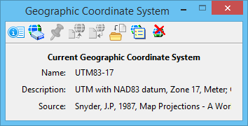
Opens the Geographic Coordinate System dialog, which is used to select a geographic coordinate system (GCS) from a library of predefined geographic coordinate systems. Opens the Geographic Coordinate System dialog, which displays the currently selected geographic coordinate system (GCS).